The rapid expansion of Lowell after its incorporation in 1826 put the surrounding areas such as Chapel Hill under regular pressure for development. Even as the neighborhood became more densely occupied over the next century, a tradition of cultivating open spaces, whether through public parks, institutional grounds, memorials, or residential gardens, became an identifying feature of Back Central.
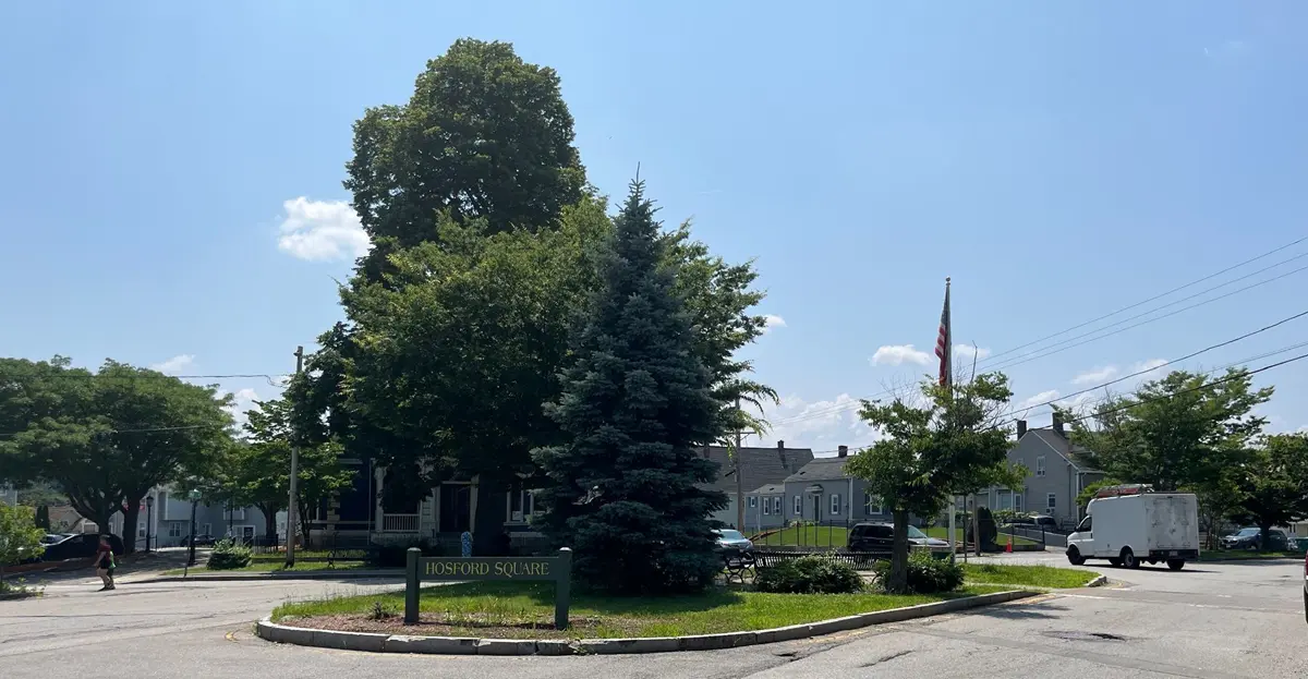
Hosford Square
The urban square at the intersection of Central Street with Mill Street (now known as Hosford Square) first appears on the 1825 map of Lowell and resulted from the combination of local topography with early industry. At this juncture, Central Street continues to curve to the southwest around the base of the hill and Mill Street sloped down to the mill at Massic Falls on the Concord River. The square was later named for Hocum Hosford, who lived nearby at 574 Central Street and served as mayor of Lowell from 1862-64.
Massic Falls
This plan represents one of the earliest attempts to divide and sell off parcels of land for residential development. Beginning in the late 1790s, Nathan Ames, a blacksmith from Chelmsford, started buying up land along the Concord around Massic Falls. In the 1825 map of Chelmsford a large parcel of land is identified with his name. In 1828 he sold his property to a group of men who incorporated as the Massic Falls Manufacturing Company to produce cotton and woolen goods, as well as iron and paper. Although not immediately developed, the numbered lots established property boundaries and two new streets, Ames and Middle (now Richmond).
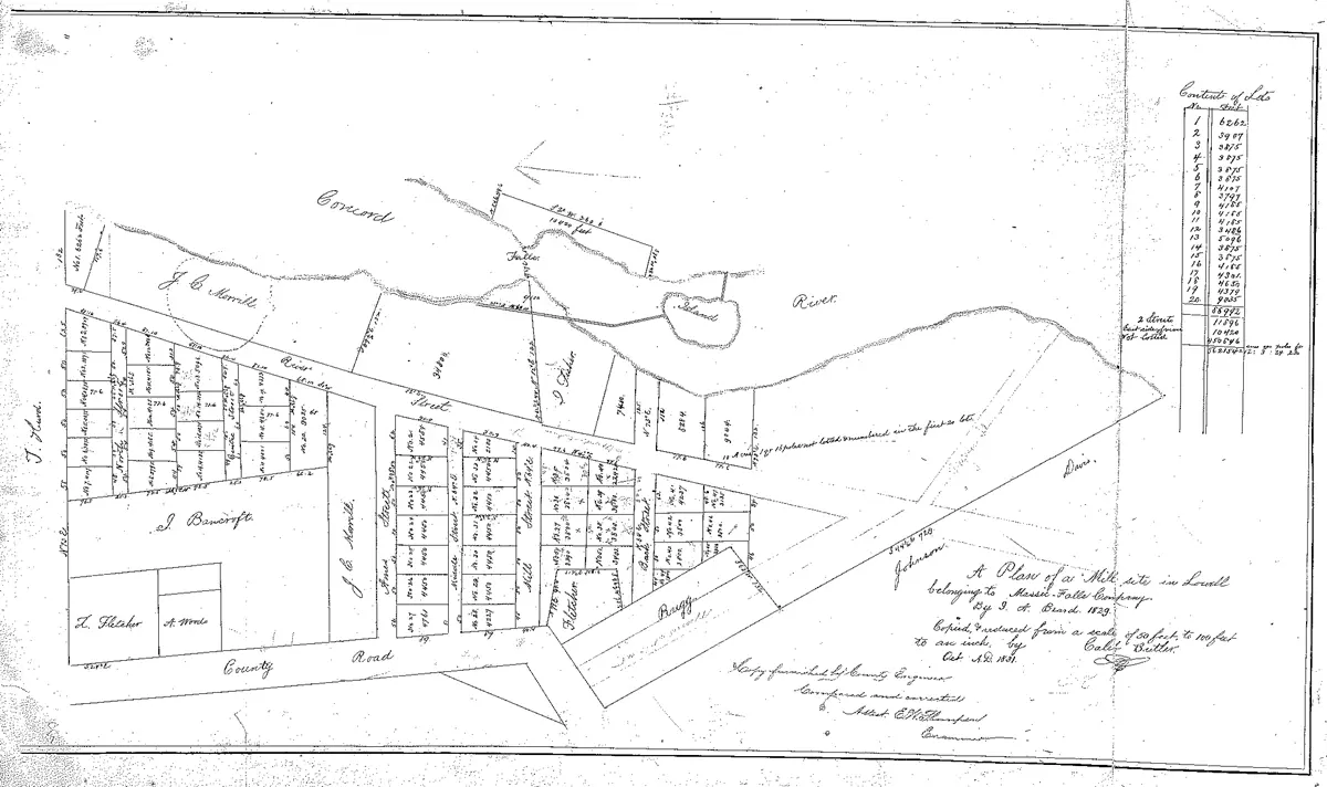
A Plan of a Mill Site in Lowell belonging to Massic Falls Company", by I. A. Beard, 1829. Records of the Northern Middlesex Registry of Deeds.
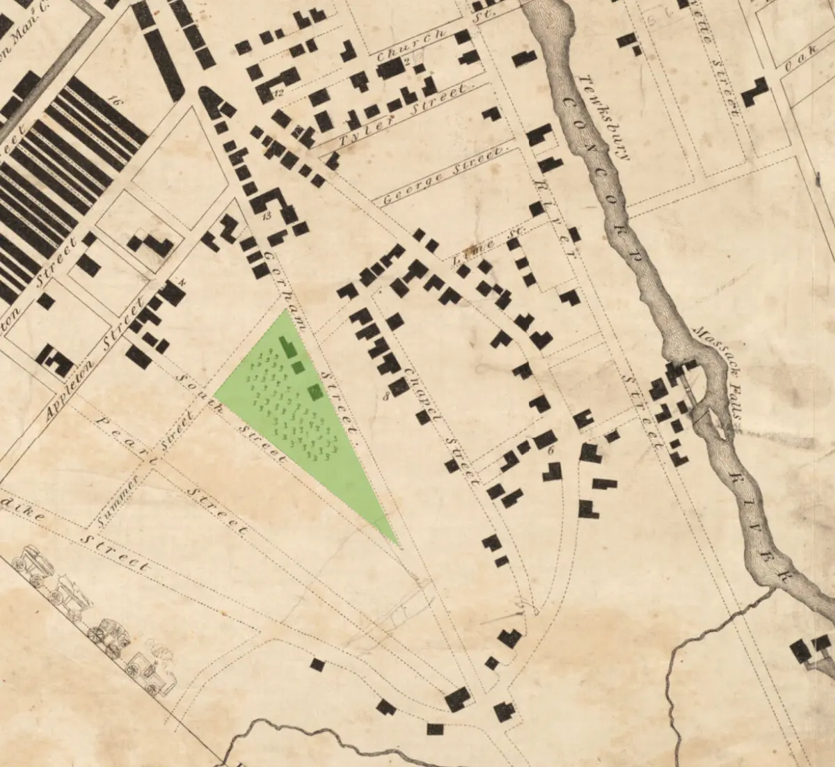
The Grove
In addition to the trees along the Concord River depicted in the 1825 and 1832 maps, another substantial stand of trees existed due west on the other side of the hill (and just south of the Appleton Mills). In the map of 1832, it is a triangular plot between Gorham, Summer, and South streets. It was popularly known as “The Grove” and when threatened by development in the 1840s generated much controversy.
Linden Street looking north, 1923, City Engineers Collection, Center for Lowell History, University of Massachusetts Lowell.
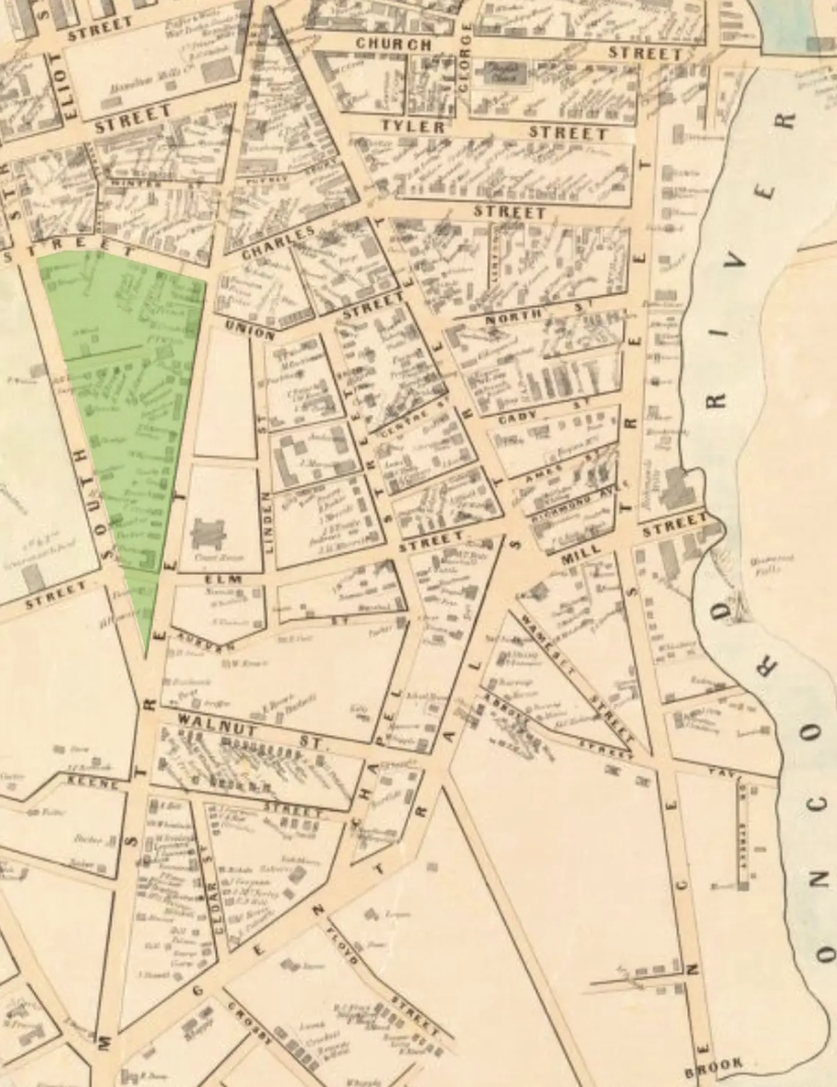
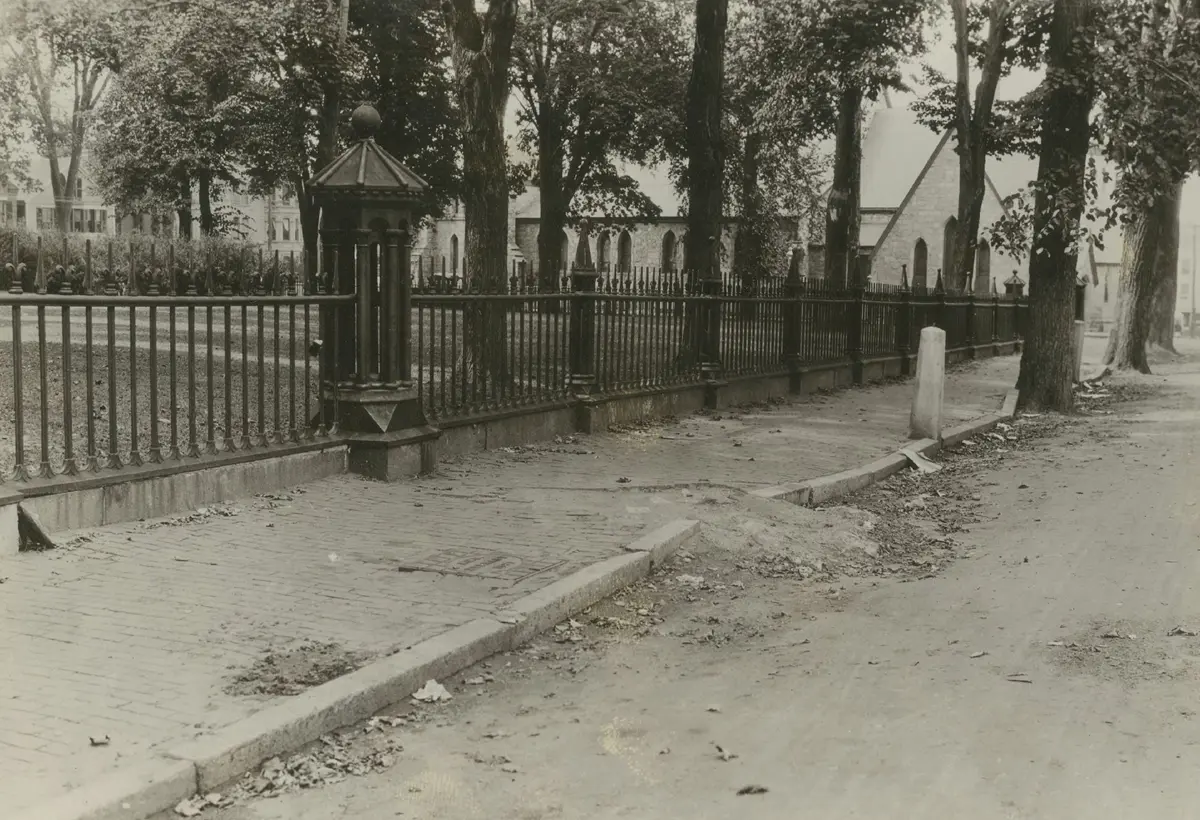
The Courthouse Grounds
The courthouse on Gorham Street occupied a large open lot. Even after the expansion of the building in the 1890s (which necessitated moving the original building designed by Ammi B. Young further back from Gorham Street), there were open grounds with shade trees surrounded by a cast iron railing. The presence of St. John Episcopal Church visible in the photo) added to the civic square character of the space. Residents of Linden Street faced this open, park-like setting.
Elm Street looking west with the courthouse grounds on the right, 1929. City Engineers Collection, Center for Lowell History, University of Massachusetts Lowell.
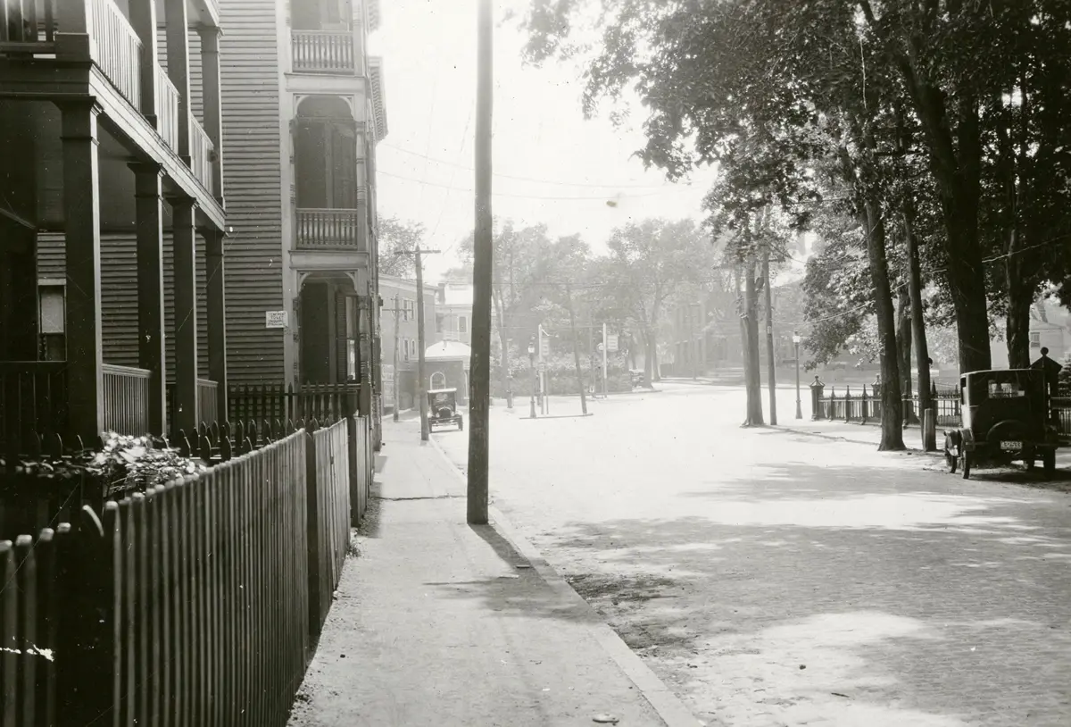
Elm Trees in Back Central
Although densely developed by the 1920s, many of the Back Central streets were shaded by mature elm trees. Elm Street no doubt earned its name from the elms planted along its length. This photo was taken in 1929, just one year before Dutch Elm Disease arrived on the continent and devastated the American Elm species, Ulmus Americana. The loss of this tree from the American landscape, and specifically urban landscapes like Back Central, cannot be underestimated.
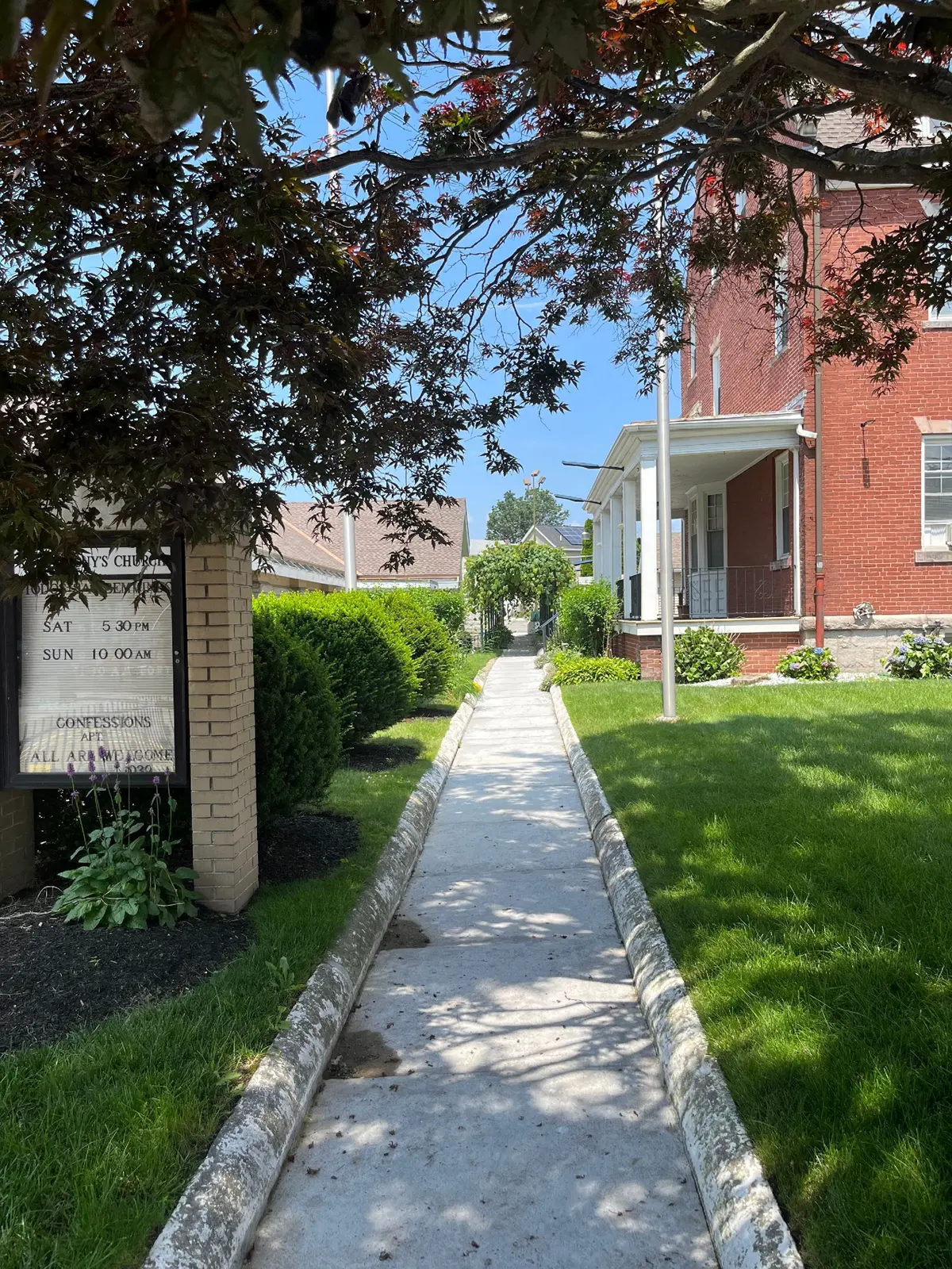
St. Anthony’s Rectory, Central Street
In 1906 a new rectory was built for St. Anthony’s Church. Father Joachim Rosa, the first pastor of the new parish, provided plans for a garden that included plants and flowers native to the Azores. In addition, he laid out a small pasture where he raised goats to remind himself of his family’s farm on Pico Island. There is also an arbor on the walkway between the rectory and church which has likely been in place for many years. A subsequent pastor of the church, Father Joseph Grillo, continued to use the open space of the rectory grounds for church festivals and picnics. Much of the north side of the property was converted to parking at a later date.
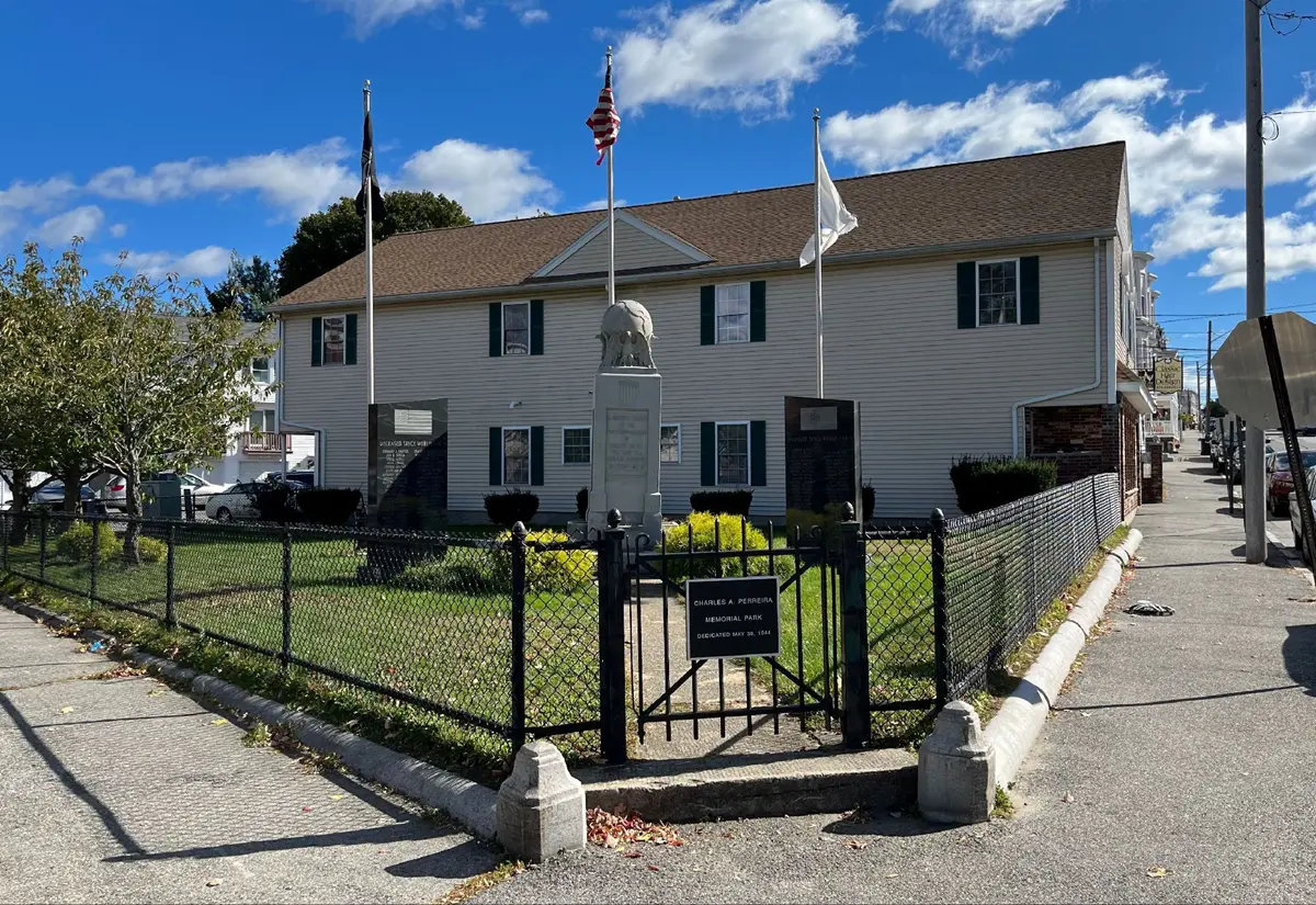
The Charles E. Pereira Memorial at Charles and Central Streets, 1944.
Pereira Memorial
By 1915 Lowell’s Portuguese population numbered nearly 4,700 men, women, and children and majority lived within a three-block vicinity of Charles and Summer streets. From 20 to 40 persons lived in these dwellings in small cold-water flats, typically with one water-closet on each floor. Crowded and unsanitary conditions in these homes led to extremely high mortality rates. Between 1900 and 1910, in a tenement at 146 Charles Street, which was home to several Azorean families, at least one child or infant died each year. Charles E. Pereira survived his childhood on Charles Street but not World War II. Pereira enlisted in the U.S. Army in 1942 and was among the first to land on the beaches of North Africa. He was killed in action two days after this amphibious landing—the first Lowell serviceman to die in combat in WWII. Portuguese community members established a memorial for him in 1944 on land donated by Manuel C. Picanso. This small memorial park provided a pocket of green space in the densely settled neighborhood.
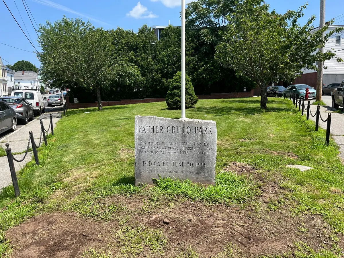
Father Grillo Park at Central and Chapel Streets.
Father Grillo Park
Father Joseph Grillo was a long-serving and highly regarded pastor at St. Anthony’s Church. He was appointed in 1923 and remained a central figure of the Portuguese community until his death in 1948. To commemorate him, his parishioners petitioned for the creation of “Father Grillo Park” just opposite the church and rectory at the intersection of Central and Chapel Street. The creation of the park is an important instance of reclaiming open space within Back Central. The site of the park had been occupied by a wood frame structure in the first half of the 20th century; sometime around 1950 the site was cleared but lay dormant. In the 1990s, the park was officially dedicated to Father Grillo.
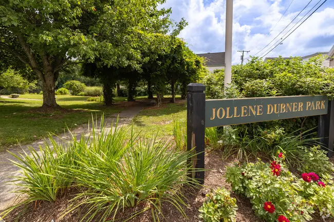
Jollene Dubner Park on the Concord River, 2000.
Jollene Dubner Park
The Concord River had been an early amenity of Back Central when estates like the Lawrence Wentworth included gardens that sloped down to its banks. Industry and heavy development soon cut off public access to the river. In 2000, through the efforts of the Lowell Parks and Conservation Trust working in partnership with the city of Lowell, public access was again reinstated at Jollene Dubner Park, situated on a quarter-acre just north of the Rogers Street bridge. The park is named Jollene Dubner, a resident of Lowell passionate about environmental protection and an original incorporator of the LP&CT. The park also connects to the Concord River Greenway, a recreational trail managed by the city that also dates to 2000.
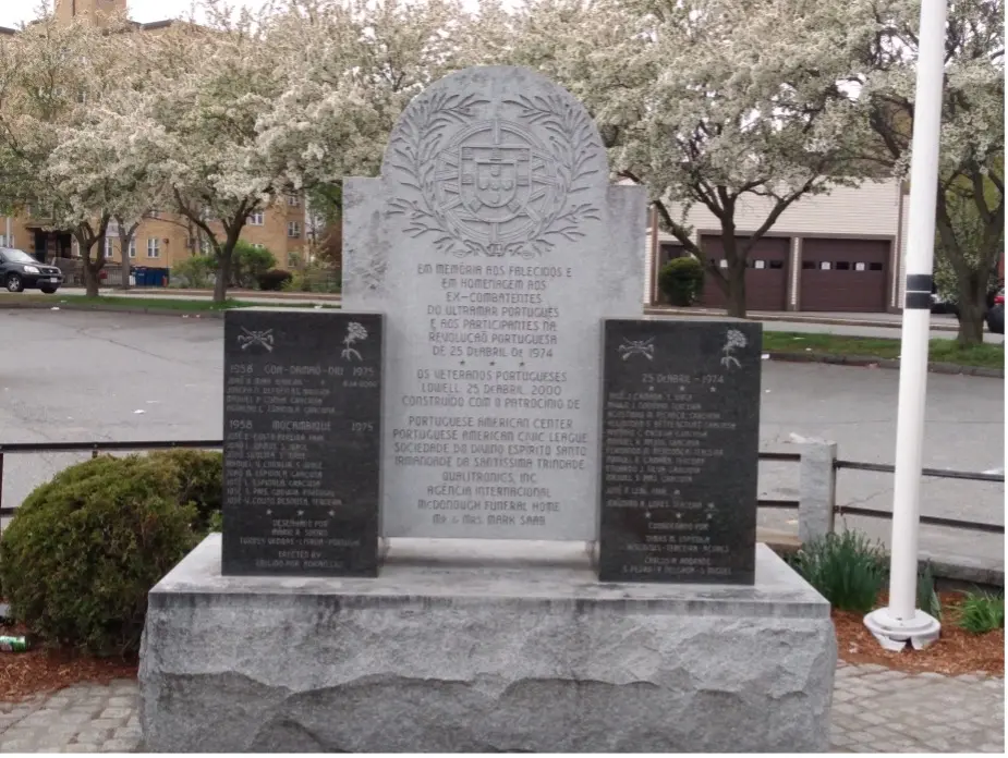
Memorial on Charles Street between Central and Gorham Streets.
Lowell Portuguese Veterans Park
Installed in 2000, this monument with a granite central entablature, flanked by two, inscribed marble blocks, honors Portuguese military veterans of Lowell who died in the Colonial Wars waged by Portugal’s Estado Novo in the 1960s and 1970s, primarily in Africa and India. It also pays tribute to Portugal’s Carnation Revolution of 25 April 1974, which overthrew the authoritarian regime that had dominated the nation for nearly a half century.
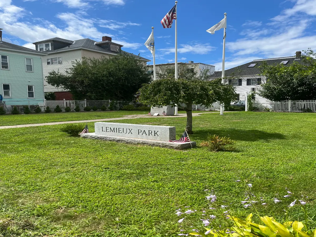
View of the park from Mill Street.
Walter Lemieux Memorial Park
This park, dedicated in 1998, runs between Mill and Richmond streets and serves as a memorial to Vietnam veteran Sp-4 Walter J. Lemieux (1947-1969) who served as a medic for the U.S. Army. Killed in the line of duty, he posthumously received the Army Commendation Medal. Lemieux grew up at 21 Mill Street, the son of Aurora and John I. Lemieux. His mother, Aurora Silva, was the daughter of Raphael and Gertrude Silva who worked as weavers at the Appleton Mills in the 1920s. The park occupies the site of a former wood frame tenement that stretched between 8-10 Mill and 7-9 Richmond.
Residential Gardens and Arbors
The loss of elm trees in the neighborhood beginning in the 1930s meant the loss of a shade canopy for residents. Many Portuguese adapted however by planting grape arbors in their backyards and adjacent to their driveways. Some properties retained large yards which were also planted with shrubs, arbors, and flowers, but even small strips of space offered the potential for gardens.